UN
6 Marwell Road
£ 68,000
Description
We don't have a Description for this property.
- Bedrooms
- 1
- Bathrooms
- 0
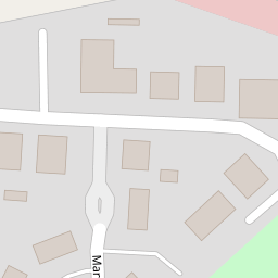


Leaflet © OpenStreetMap contributors
The heatmap indicates the level of crime in the area. The color of the heatmap indicates the crime severity and recency.
Metrics Year-on-Year
- Average area value
- 614,553.00 £Decreased by 4.98 %
- Average area rental value
- 1,589.00 £/moDecreased by 8.10 %
- Est rental Yield
- 3.10 %Decreased by 3.43 %
- Crime Rate
- 20.00 %Unchanged by 0.00 %
from 646,729.00 £
from 1,729.00 £/mo
from 3.21 %
from 20.00 %
Nearby Schools
| Name | Type | Ofsted | Distance |
|---|---|---|---|
| Turners Wood, Fleet Fireflies And Wild Rose Children'S Centre | Children's Centre | 0.68 KM | |
| Elvetham Heath Primary School | Community School | Outstanding | 0.68 KM |
| Calthorpe Park School | Community School | Good | 1.65 KM |
| Tavistock Infant School | Community School | Good | 2.04 KM |
| All Saints Church Of England Aided Junior School | Voluntary Aided School | Good | 2.19 KM |
Images
Nearby Streets
| Name | Average Price | Average Sqft | Distance |
|---|---|---|---|
| Cheriton Lodge | £ 0 | 0 | 0.00 KM |
| Oakhanger House | £ 0 | 0 | 0.00 KM |
| Home Farm Road | £ 0 | 0 | 0.00 KM |
| Mellows Close | £ 0 | 0 | 0.00 KM |
| The Willows | £ 512,500 | 0 | 0.00 KM |
Nearby Transport
| Name | NLC | TLC | Distance |
|---|---|---|---|
| Fleet | 5522 | FLE | 3.49 KM |
| Winchfield | 5528 | WNF | 5.04 KM |
| Sandhurst (Berks) | 5646 | SND | 8.70 KM |
| Crowthorne | 5628 | CRN | 9.41 KM |
Nearby Listings
| Address | Price | Type | Score | Distance |
|---|---|---|---|---|
| Lyndhurst Road, Fleet, GU51 | £ 420,000 | BUY | Unknown | 0.13 KM |
| Longmoor Court, Fleet | £ 350,000 | BUY | Unknown | 0.14 KM |
| Longmoor Court, Fleet, Hampshire | £ 475,000 | BUY | 6 / 10 | 0.15 KM |
| Longmoor Court, Fleet | £ 375,000 | BUY | Unknown | 0.15 KM |
| Upper Mount Street, Fleet, Hampshire, GU51 | £ 750,000 | BUY | 6 / 10 | 0.15 KM |
Nearby Properties
| Address | Price | Distance |
|---|---|---|
| 6 Marwell Road | £ 68,000 | 0.00 KM |
| 2 Marwell Road | £ 117,000 | 0.00 KM |
| 10 Marwell Road | £ 325,000 | 0.00 KM |
| 3 Marwell Road | £ 430,000 | 0.00 KM |
| 12 Marwell Road | £ 122,500 | 0.00 KM |